 Deutsch
 Español
 Français
 Italiano
 Nederlands
 English
Sale!
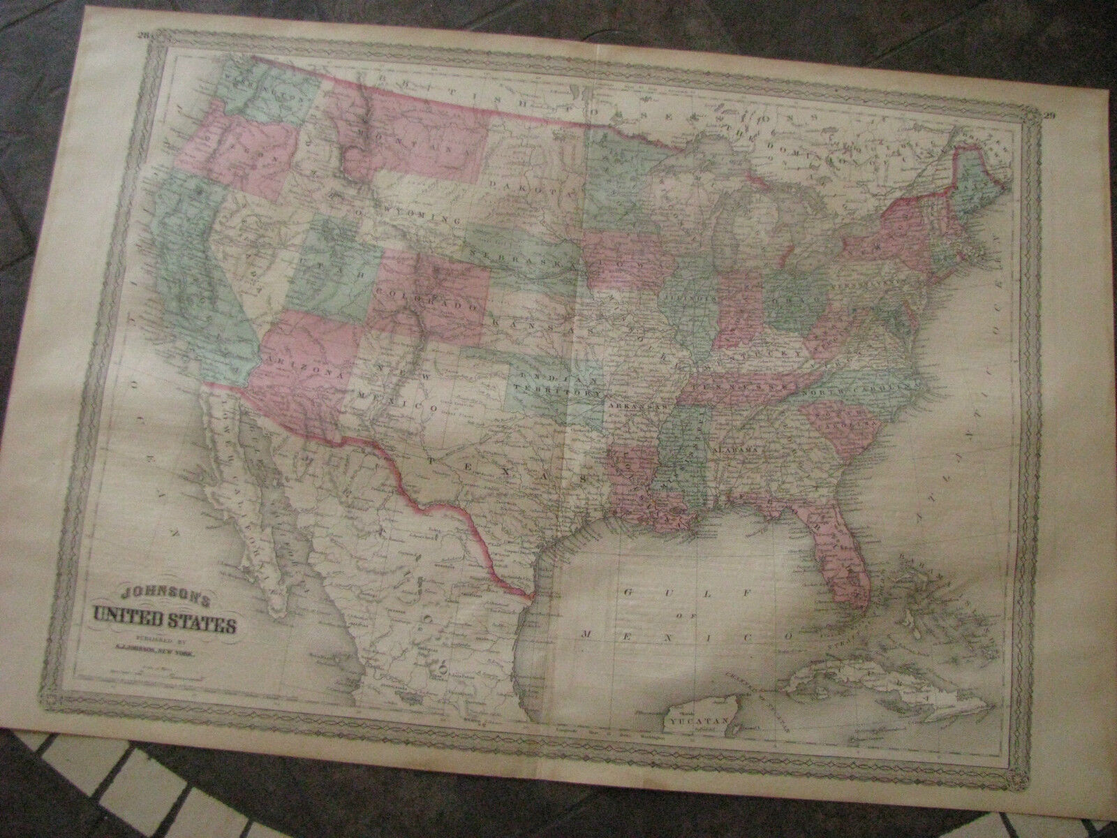
1868 ORIGINAL Huge Map United States & Territories
$52.79
61
- Year: 1868
- Condition: avg
- Format: Atlas Map
- Original/Reproduction: Antique Original
- Country/Region: United States of America
Description
Original hand colored engraving as issued.
Engraved by J.H. Young.
Entered into US Congress by Alvin J. Johnson.
Image area is 23.0″ wide x 17.0 high including ornate border.
Interesting and detailed map published after the Civil War..
Shows chief cities and railroads.
Oklahoma, is “Indian Territory.”
Dakota Territory is not yet divided.
Shows the Pony Express Route and proposed railroads.
Beautifully executed, attractive hand color, will frame nicely.
Overall average condition with moderate ageing.
There is some typical toning and spotting for an item of this age. See photos.
The centerfold is intact.
Low starting bid with no reserve.
Postage charge is for domestic insured priority mail.